
Greenwater, WA
There are 8 trails in Greenwater where dirt bikes are allowed. Before embarking, you might want to check the
status.
- Christoff - Trail 1171 - 3.1 miles ea. way
- Directions: FS 7130 to connect with Divide Ridge trail
If you need to get back to the road, it works. I think the last time Walt and I missed a sign and followed a game trail, so I'm sure the posted one works much better.
- Colquhoun Peak - Trail 1195 - .5 mile ea. way
- Directions: FS 7030 to the top of the hill, turn right, then right again.
Haven't ridden it yet. Pretty short, so I'm not sure it's worth unloading the bike...
- Dalles Ridge - Trail 1173 - 1.8 miles ea. way
- Directions: FS 7250 - then the 210 spur to the end.
Haven't ridden it yet. A funky little spur that connects a bunch of hiking/horse trails. Not sure why you'd want to ridge this one...
- Divide Ridge - Trail 1172 - 8.5 miles ea. way
- Directions: The west end is off FS 7125 (Slippery Creek), the east end off the end of FS 7032. You can also pick up the middle: westbound from FS 7010 (end of the road) or west/eastbound from the crest of FS 7012. Can also use Christoff to drop to FS 7130.
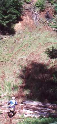
My favorite Greenwater trail, and one of all-time favorites. Hardly used, this trail crosses Huckleberry Mountain which has lots of huckleberries around Labor day. The trail is pretty technical to the east of the FS 7012 junction.
NOTE: Several areas have been logged off, so the trail can be hard to follow. Where you come off the hill (headed west) at FS 7012, veer right (north) down the hill, take the first left and back up to the trail. When you get to the spur off 7010, go left (west) and follow the road to the end.
- Frog Mountain - Trail 1180 - 3.1 miles ea. way
- Directions:FS 74 all the way to the end. Trail ends on the 904 spur, which is the last road to the right before you reach the end.
Hideous trail - steep and switchy. Ugh.
- Grass Mountain - Trail 1170 - 6.0 miles ea. way
- Directions:Around FS 7120 somewhere, but my maps aren't consistent.
Haven't ridden it yet. I wonder if it even still exists, since it looks to be on Weyerhaeuser land, and we know how much they love dirt bikes.
- Naches - Trail 1175 - 5.7 miles ea. way
- Directions:Follow FS 70 to at least FS 7033, where the trail will begin crossing the road several times.
Remember it doesn't open until July 15, but it's a great way to get to the trails on the other side of Chinook Pass without having to drive the pass. See Naches Trails for more info on opportunities there.
- Suntop - Trail 1183 - 8.3 miles ea. way
- Directions: Take the Buck Creek (FS 7160) turn, then first left parallel to the Ranger Creek Airstrip. Toward the end of the airstrip, you'll see the trailhead sign on your right.
This one separates the men and the boys. I'll stay at camp with the coffee, thanks. I quite honestly have only ridden the first portion to road 310 and was way too tuckered after that. More power to ya!
Back to the Dirt Page